.jpg)
.jpg)
.jpg)
.jpg)
.jpg)


.jpg)

 Maximize
 Maximize

Maps as detailed as paper maps, clear!
Choose the area of your choice by clicking on the link below and then enter the REFERENCE in the field 'Comments' of the order process. / Click here to choose your navigation area (see bottom of page site Navionics)
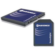
To provide fishermen and knowledgeable boaters a clearer map with details are the same as for paper maps, Navionics goes further than the simple scanning cards official paper.
Gold cards are established to allow smooth playback and a readability perfect at every zoom level.
Display technology offers a quick, gentle and transition continues from one area to another, regardless of the chosen scale.
Gold mapping includes the curves of shaded levels, sectors of the navigation light in color, shapes and real colours of buoys and the symbols of navigation to facilitate the approach phases.
Survey points, data of tides and currents, detailed plans and port services guides provide complete information for a simpler and safer navigation.
The new feature of X-Plain translated with a simple click of the cursor symbols of navigation in plain language and understandable by everyone.